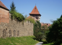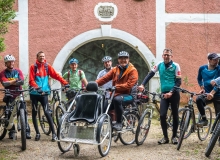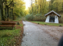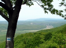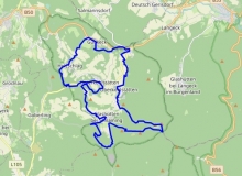
Walk along the 16th century fortifications
The first troops of the Turkish army arrived in Kőszeg on 5th August, 1532. By 10th August, the town was surrounded by the Turkish blockade.
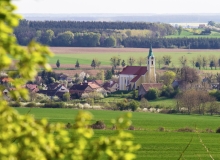
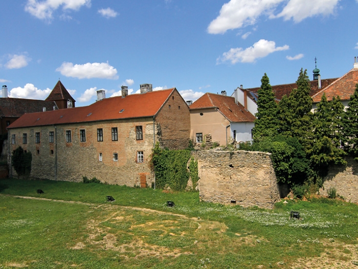
The castle and the town’s defence system strategically formed an integral unit. The fortifications of the town were much more significant in the 16th century than the castle itself, which remained the attraction of the castle-town built in the 13th and 14th centuries. For this reason, in the case of Kőszeg we can speak about the siege of the town, and not about the siege of the castle. Fortifications similar to Kőszeg were all occupied by the troops of Suleiman in the following years. During this time, only 4 castles could defend themselves: Kőszeg defended the town in 1532, Temesvár in 1551, Eger in 1552 and Szigetvár in 1556. While Temesvár and Eger were besieged by Ahmed Pasha and Szigervár by Khadim Ali Pasha, Kőszeg defended itself successfully against the invading Ottoman army under the nominal command of Sultan Suleiman the Magnificent.
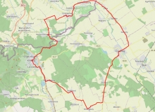
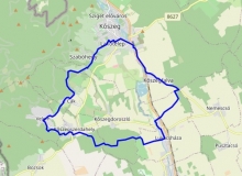
Térkép
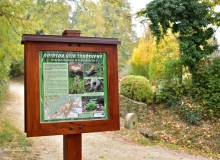
Látnivalók
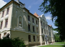
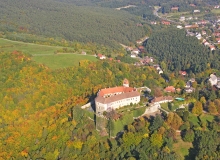
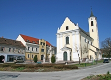
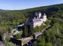
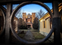
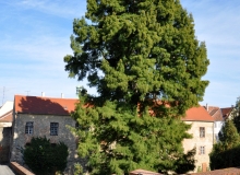
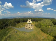
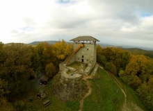
1. Castle, Rájnis J. u. 9. GPS: 47.389670 / 16.538719

The castle and the adjacent town created a unified defence system and so was one of the most unusual castle towns in Hungary. Although the castle was one of the most important parts of the fortification system, with its outer and inner bailies and the surrounding moat, it was not complete without the town. On the wall walk one can see the corner bastions with loopholes and places for cannons, most of which might have been built after the siege.
További információk
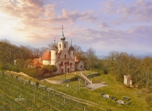
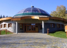
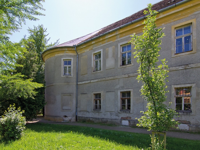
Castle Jurisics is our largest historical memorial, where the late gothic and early renessiance castle corridor is one of the most beautiful of its kind within Hungary The former Landowner’s Castle surrounded by town-wall and the moat is situated in the north-western corner of the inner city. In the Castle Courtyard, the earliest remnants of the former pile-dwelling were found. After the Siege by the Tatars in mid-13th century, they started to build this lower castle in the valley beside the settlement. This lower castle substituted the former upper castle’s role in the middle age, as the upper old castle was too complicate to be approached for trade and administration.
The castle have two distinct parts: the Outer and the Inner Castle. The guards and the service personnel of the castle was settled in the buildings of the Outer Castle. At the end of the 13th Century its owner was the Heder family. Prince Habsburg Albert took the castle in 1289. Andrew III, the last king of the Hungarian Arpad House ruined the upper old castle int he Kőszeg hills, according to the terms of the Hainburg treaty.
In 1327 the Anjou king Carlo Roberto took the castle from the family Kőszegi after harsh years of fightings. He gave strong royal privilages to the town after his victory. Town walls with strong towers were built protecting Kőszeg against the onslaughts of the Austrians. The water of the river Güns (Gyöngyös) was directed into the moats around the castle walls. The castle went to the Garai family in 1392, then to the Habsburg family until the renessiance Hungarian King Mathias Corvinus took it back in 1482. The Habsburgs took Kőszeg again after the death of Mathias in 1492.
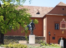
The most wellknown Siege of Kőszeg happened in 1532, when the Ottoman Sultan Suleiman attacked Kőszeg fiercly with his 80 thousands soldiers on his way to Wien. The Captain and Protector of the Castle, Nikolaus Jurisich has its sculpture today in the outer courtyard. Even today, there is a festive 11 o’clock bell-ring in Kőszeg conmemorating the ending of the month-long, unsuccessful Ottoman Siege in 1532.
A brick bridge over the moat leads us to the inner castle. Just next to the gate we can find the traditional herb-garden of the castle, together with a smal handicraft shop, the Nature Shop where one can buy the traditional products of the Kőszeg region and the Írottkő Nature Park. A nicely planned inner court receives us behind the gates. A rich Castle Exchibition is located in the southern and eastern wings. Centuries of Kőszeg exhibition, the Royal Crown Room, the Golden Room and Armoury awaits the visitors. The renessiance corridor and the Cavalier’s Room gives place to numerous cultural events and to various art exchibitions.
More information: www.jurisicsvar.hu
2. Lower Gate Tower, Városház utca 1. (The Heroes’ Tower) GPS: 47.388691 / 16.541097
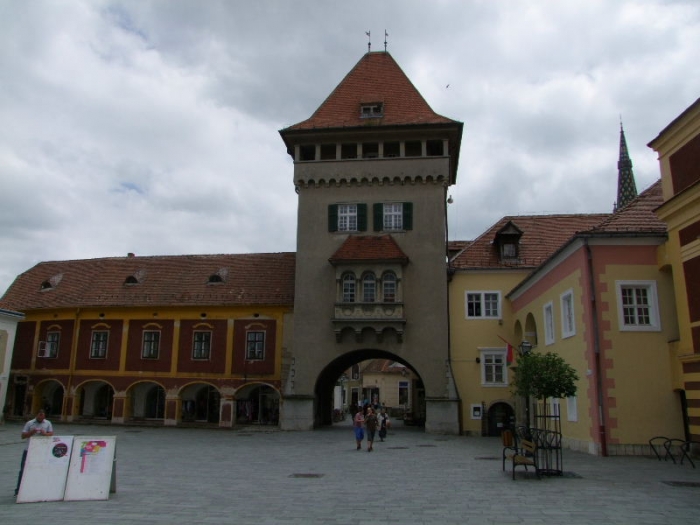
The most defended and best-built part of the town was located at this place. Over the moat there was a drawbridge until the 18th century. The barbican, the wall on the other side of the moat, and the small bastion protecting the bridge were already standing at the time of the siege. The Lower Gate Tower was guarded by 42 guards, 3 quarter masters and 4 corporals. Among the weapons, there were 22 rifles and a cannon.
További információk
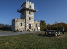
The Heroes’ Tower was erected above the southern town-gate in 1932 in an eclectic style, for the 400th anniversary of the great Ottoman Siege. The Southern town-gate was erected int he 14th century and demolished in 1880. The old tower was a central point of the town’s protection and trade. The tower musicians who had special rights and tasks in town, also lived here. In today’s Heroes’ Tower there is a Museum since 1977, where exciting memories of the historical local handicrafts may be studied. There is a panorama corridor on top, that lends you the perfect inner city panorama & photo opportunity. The historical tower music of Kőszeg may heard on the great Festivals. Ono ne side, there is the Captain House, ont he other side the Kőszeg Archive building beside the tower.
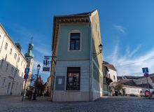
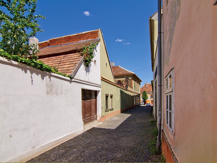
3. Town walls, Chernel K. u. 11. GPS: 47.38830332452373 / 16.539912453117996
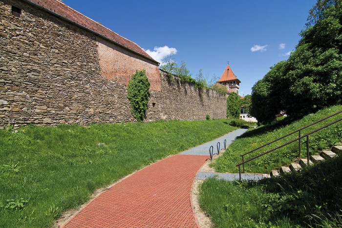
The size of the old town walls can be seen best between the Old Tower and the Heroes’ Tower. Town dwellers were required to build a strong town wall in 1336 in return for tax exemptions for 10 years. The stone walls started to be built in the 14th century and they might have been completed in the 15th century. The 160-180-cm wide old wall was built from stone or clay. Loopholes and wall walks were built in.
További információk
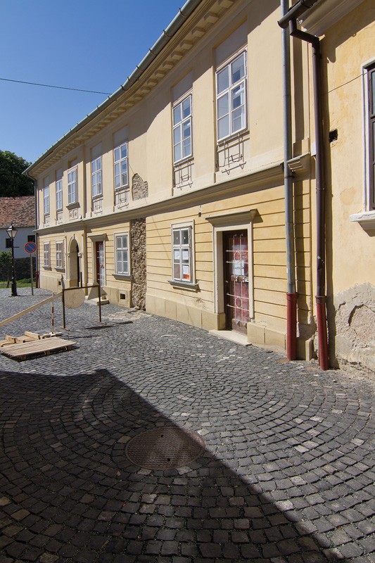
This house was rebuilt in the 17th-18th centuries in the Baroque style and then in the 1820s in Classicist style. The house, which was built on the town wall next to the General House, was owned by the Oberer family in the 18th century. One of its notable dwellers was painter János Oberer.
In 1884, lawyer József Markovits purchased the house. He is known for developing local tourism as the leader of the Kőszeg Tourist Society. Headmaster István Arató also lived in the house between the two world wars. He was the first in Hungary to introduce the method of teaching in specialised classrooms.
4. Old Tower (Zwinger), Chernel K. u. 14. GPS: 47.388179 / 16.539544

The nonagonal bastion is the oldest part of the town’s defensive system. It was supposedly built in the 13th century, but some claim it was built in the 15th century. It provided protection for the Lower Gate Tower and the southern and the western town walls. Its guarding staff included 4 quarter masters, 5 corporals and 45 guards equipped with a cannon and 26 rifles.
További információk
It is the earliest known tower of the town’s defence system. It has 9 walls, and was a real stronghold in the great Ottoman Siege. It is held to be built in the 13th century, together with the earliest pile-castle. The location of the tower secured its pivotal defensive role between the Southern town-gate and the Southern townwall as well as along Western townwall. In 1575, the guards of the tower consisted of 1 wheeled cannon, 26 rifles of the age, 4 leading men 5 corporal soldiers and 45 soldiers.
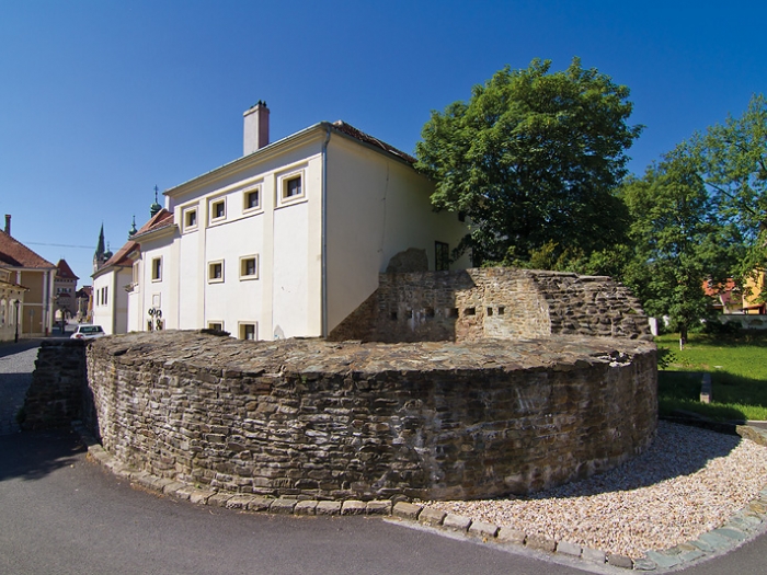
5. New or Corner Tower, Chernel K. u. 14. GPS: 47.388445 / 16.538986
The new fortification was built in the middle of the wall between the Old Tower and the castle just before the siege. Its shape is different from the other towers built at the same time. The rectangular tower once was built without a roof.
További információk
The new fortification was built in the middle of the wall between the Old Tower and the castle just before the siege. Its shape is different from the other towers built at the same time. The rectangular tower once was built without a roof.
6. Upper Gate Tower, Rájnis J. u. 10. GPS: 47.390182 / 16.538997
During the siege in 1532, the tower was made of wood, but it was rebuilt in 1548-1549. The tower was placed on the inner part of the town wall, with a barbican and a wooden bridge leading over the moat. In 1575, the tower was guarded by 31 guards equipped with a wheeled cannon and 15 rifles. It was demolished in 1836. The supposed floor plans of the tower can be seen on the pavement today.
7. Lombai Tower, Schneller I. u. 2. GPS: 47.390715 / 16.540644
A wooden tower supposedly stood at this site during the siege. According to some chronicles, a stone tower was built in 1546. In 1575, it was guarded by 32 personnel equipped with 12 rifles. Its name today refers to Lodnwein or Laubenwein, which might have been the name of one of the town’s most important wine storerooms. However, its first name was the Water Tower, as once a water lifting machine was placed inside the tower.
8. Fox Cape or Hangman’s Tower, Várkör 25. GPS: 47.390670 / 16.541973
The round tower attached to the outer part of the town started to be built after the attack in 1529 and was completed in the year of the siege in 1532. The idea seemed to be a good decision as during the siege the fiercest attacks by the Turkish concentrated on this part of the wall. During the siege, the neighbouring bastions, from which suitable support was probably provided, did not exist yet. The water canal feeding the moat from Gyöngyös Stream joined at this place as well.
9. Bath Tower, the later Fishing Gate, Bem J. u. GPS: 47.389819 / 16.542170
The bastion was called Badstube by the locals for a long time. It was built in 1551 in the middle of the long eastern wall between Fox Cape and Loczer Tower. The horseshoe-shaped outer tower was built to support the two corner towers and to provide more effective and closer protection for the town wall. In 1572, 34 guards and 20 rifles protected the tower. Having lost its defensive role, the tower was interrupted by a gate, which became the third entrance to the town.
Összeállította: Révész József
Fordítás (angol nyelvre): Keresztes Nóra, Angol nyelvi lektorálás: Eliza Plous
Fordítás (német nyelvre):
További városnéző séták